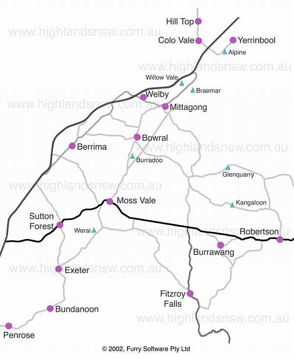
| Southern Highlands Road Map | |
Road travel tips:
Enter the Highlands from the Freeway (north) at overpasses at the Mittagong turnoff, or (south) at the Moss Vale - Illawarra Highway turnoff. You can also turn off at Berrima (overpass) or at Sutton Forest, Exeter, Bundanoon, Penrose and Tallong-Wingello (near Marulan) at side roads off the freeway. Robertson (and all points west) is accessed via Macquarie Pass from the South Coast (Wollongong and Albion Park), and Fitzroy Falls from Nowra and Kangaroo Valley.
It takes about 30 minutes to travel from one side of the map to the other (about 15 minutes north to south via the freeway). Details of on and off ramps are outlined on the Road directions page.
From Mittagong, Bowral, Moss Vale, or Berrima it is about 5 minutes drive to the next adjacent main town. From Moss Vale, Sutton Forest is 5 minutes, then Exeter 5, and Bundanoon another 5. Fitzroy Falls and Robertson are each about 20 minutes from Moss Vale or Bowral.
On the Freeway the speed limit is 110 kilometres per hour. Elsewhere limits range from 50 kph (residential areas) all the way up through 60, 70, 80, 90, and 100 kph. Motorists are advised to watch carefully for speed limit signs (which often seem to move location without warning). Patrol cars, unmarked police cars, and radar are used widely.
Beware of travelling at high speed on narrow country roads and lanes. Approach the junction of Illawarra Highway & Sheepwash Road (see map, west of Burrawang) with extreme caution. At roundabouts (there are many) give way to any traffic already in the roundabout (not just on your right); there is no priority of access for cars driving straight ahead through the roundabouts.
![]()